HOME

Ponta de São Lourenço

Ponta de São Lourenço,

Madeira,   Portugal

Ponta de São Lourenço is a breathtaking peninsula located at the easternmost point of Madeira. Known for its dramatic volcanic landscapes, rugged cliffs, and crystal-clear waters, it is a protected nature reserve and a popular destination for hiking, birdwatching, and enjoying panoramic views of the Atlantic Ocean. The area is characterized by its unique flora and fauna, making it a must-visit for nature lovers and outdoor enthusiasts.
Ponta de São Lourenço
"Ponta de São Lourenço ‐ photo by ,
©www.mgaylard.co.uk.
Ilha Deserta Grande
Ilha Deserta Grande ‐ photo by ,
©www.mgaylard.co.uk.
rugged cliff with a natural arch
rugged cliff with a natural arch ‐ photo by ,
©www.mgaylard.co.uk.
the overall mood is somber due to the grayscale color scheme
the overall mood is somber due to the grayscale color scheme ‐ photo by ,
©www.mgaylard.co.uk.
hiking trailhiking trail
hiking trail ‐ photo by ,
©www.mgaylard.co.uk.
D'Abra Bay
D'Abra Bay ‐ photo by ,
©www.mgaylard.co.uk.
D'Abra Bay
D'Abra Bay ‐ photo by ,
©www.mgaylard.co.uk.
Gorilla Rock
Gorilla Rock ‐ photo by ,
©www.mgaylard.co.uk.
D'Abra Bay
D'Abra Bay ‐ photo by ,
©www.mgaylard.co.uk.
Gorilla Rock
Gorilla Rock ‐ photo by ,
©www.mgaylard.co.uk.
Gorilla Rock
Gorilla Rock ‐ photo by ,
©www.mgaylard.co.uk.
Gorilla Rock
Gorilla Rock ‐ photo by ,
©www.mgaylard.co.uk.
rugged coastline with steep cliffs
rugged coastline with steep cliffs ‐ photo by ,
©www.mgaylard.co.uk.
Miradouro da Ponta do Rosto
steep cliffs with a reddish-brown hue ‐ photo by ,
©www.mgaylard.co.uk.
Miradouro da Ponta do Rosto
steep, rocky cliffs ‐ photo by ,
©www.mgaylard.co.uk.
Miradouro da Ponta do Rosto
Miradouro da Ponta do Rosto ‐ photo by ,
©www.mgaylard.co.uk.
The water is a vibrant blue
The water is a vibrant blue ‐ photo by ,
©www.mgaylard.co.uk.
arge rocks jutting out of the water
arge rocks jutting out of the water ‐ photo by ,
©www.mgaylard.co.uk.
Miradouro de São Lourenço
Miradouro de São Lourenço ‐ photo by ,
©www.mgaylard.co.uk.
Miradouro de São Lourenço
Miradouro de São Lourenço ‐ photo by ,
©www.mgaylard.co.uk.
Open the full set flickr button this page

Ponta de São Lourenço

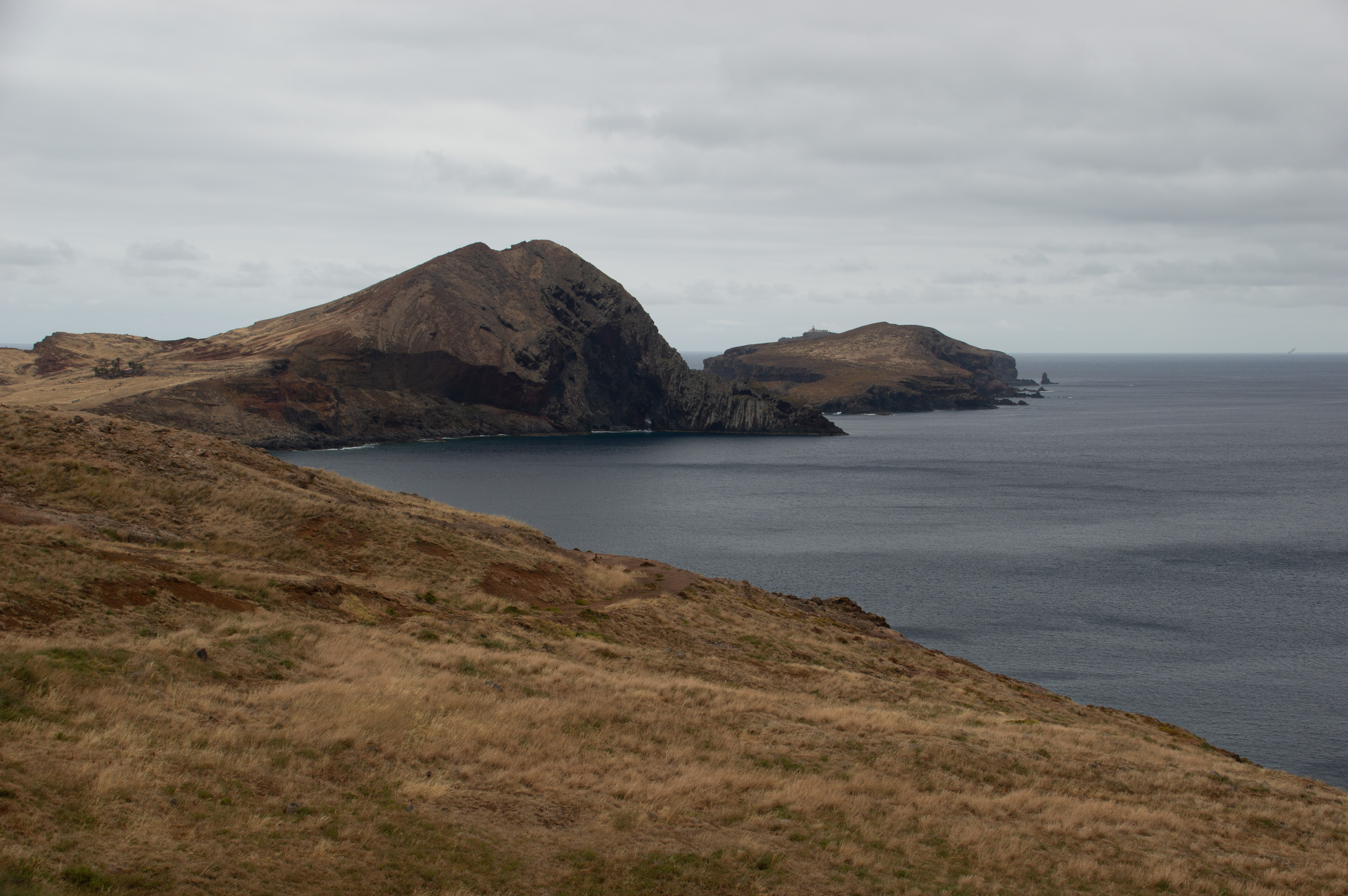
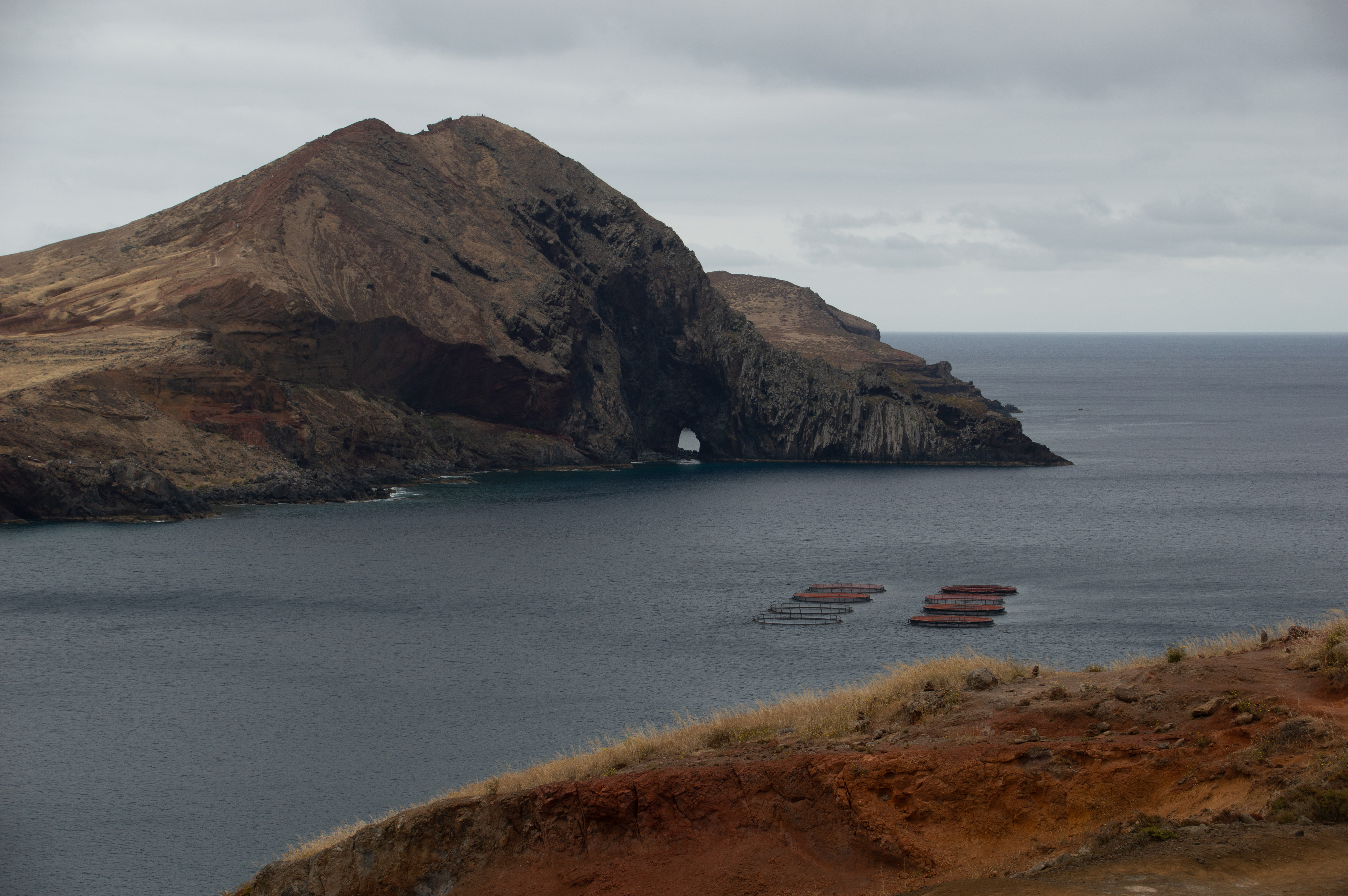
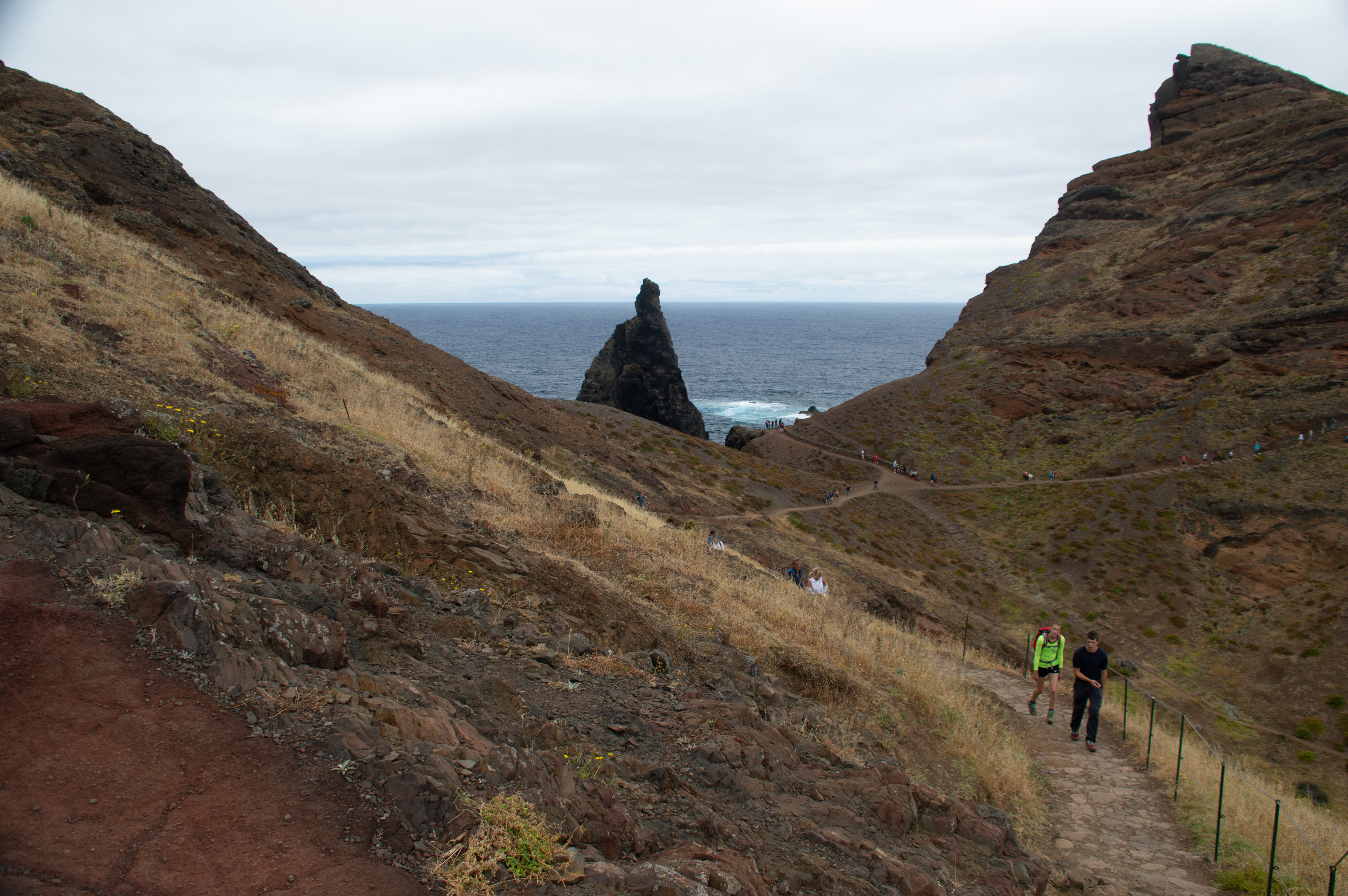
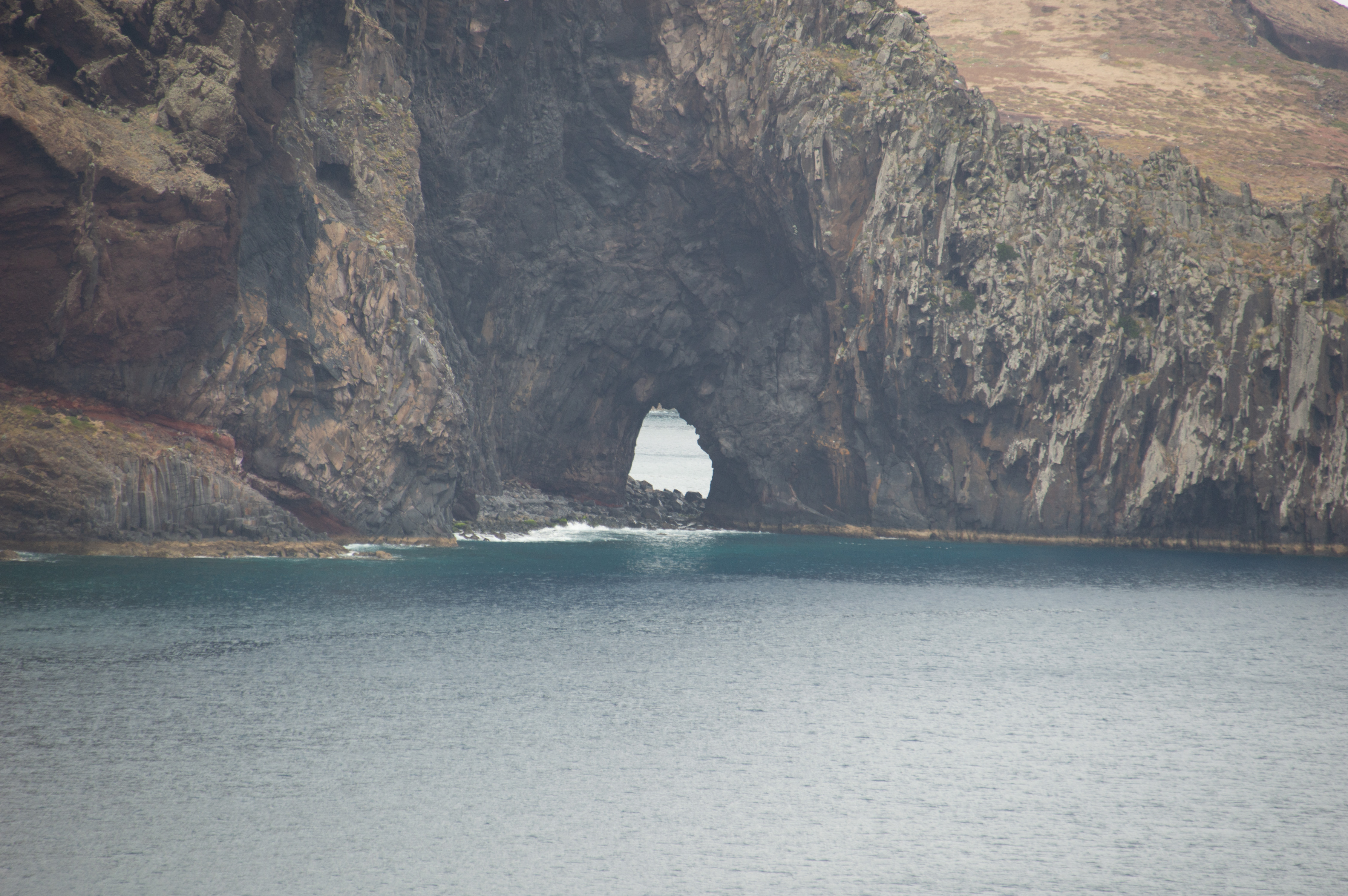
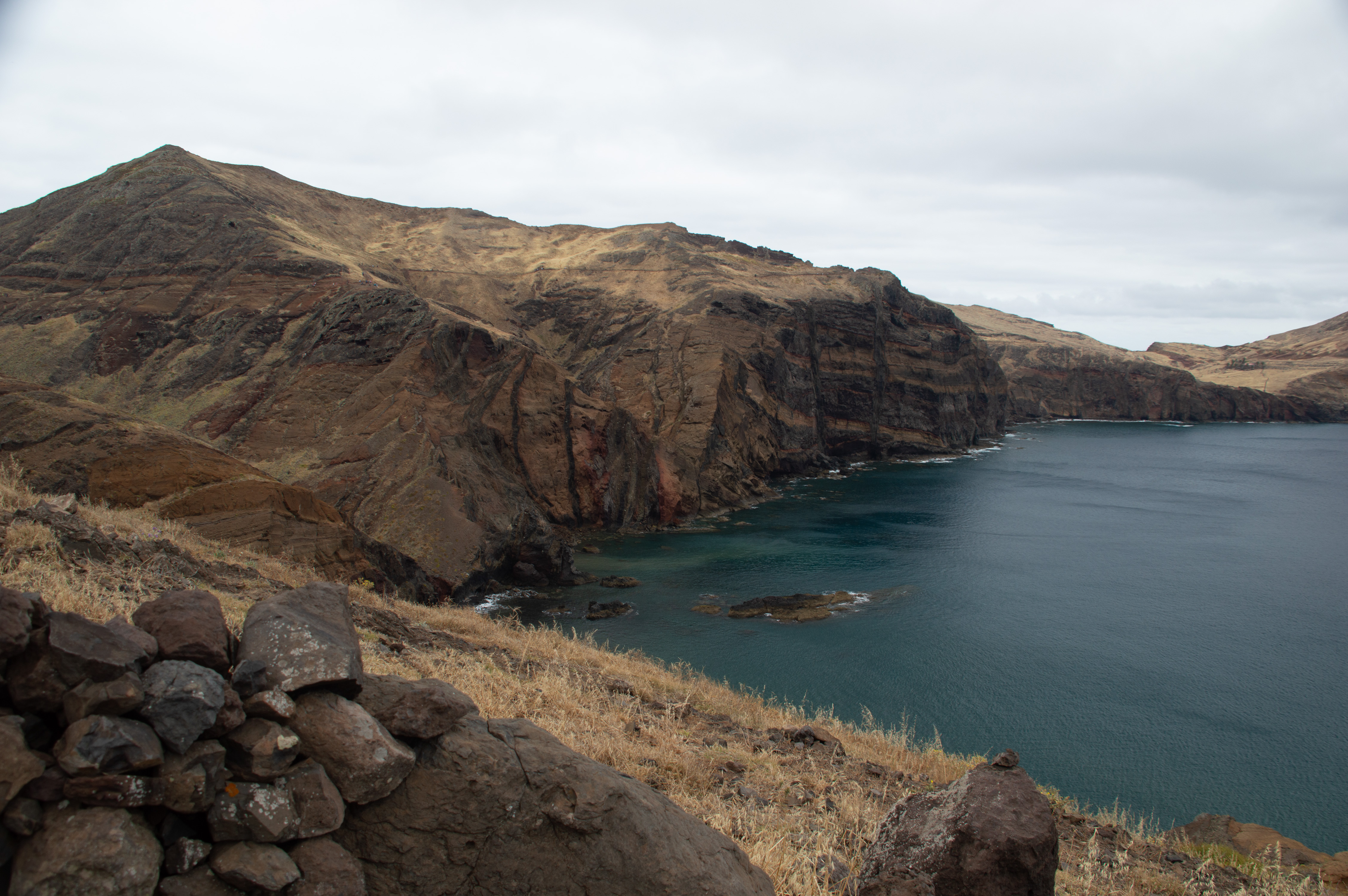
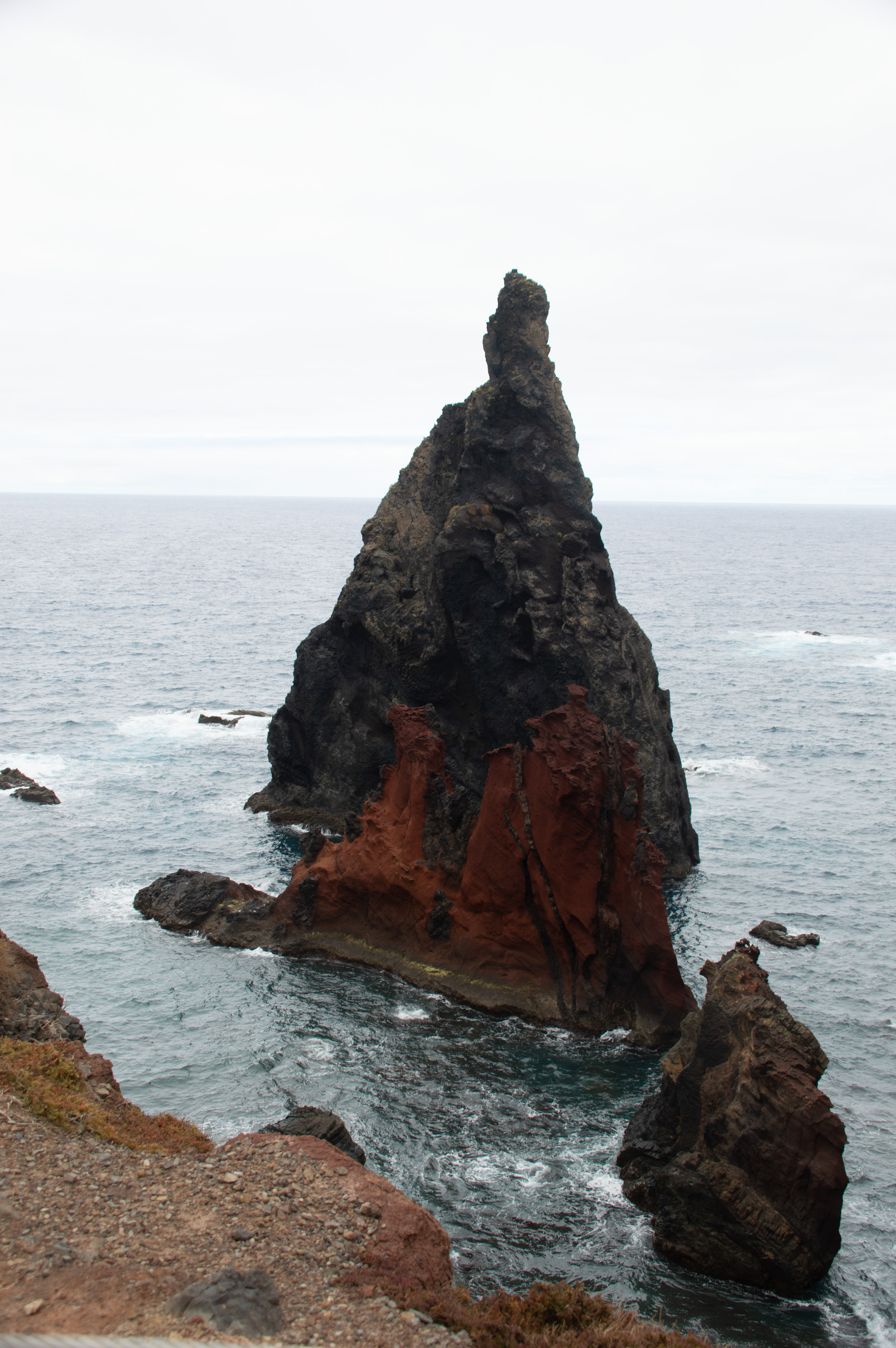
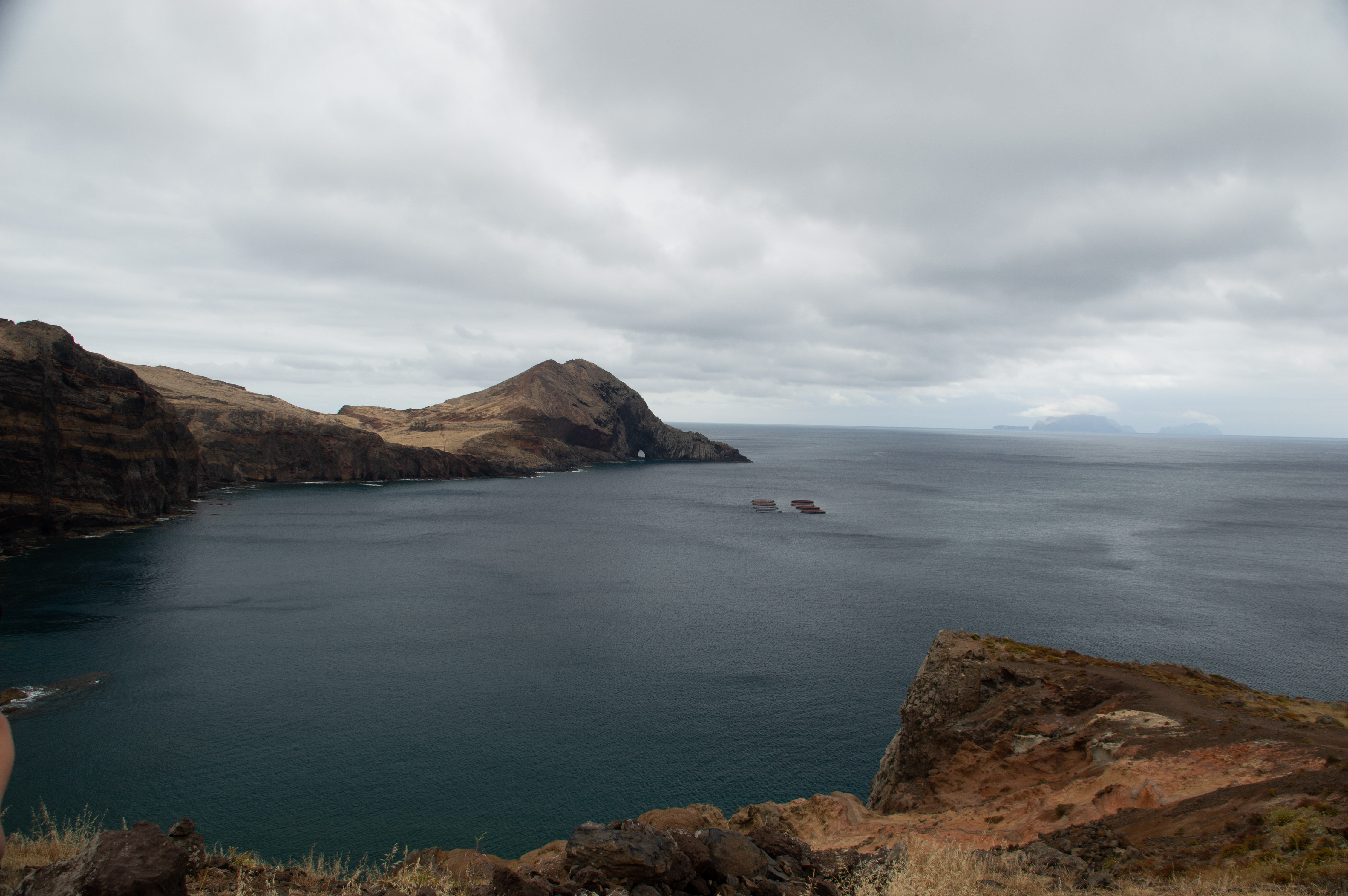
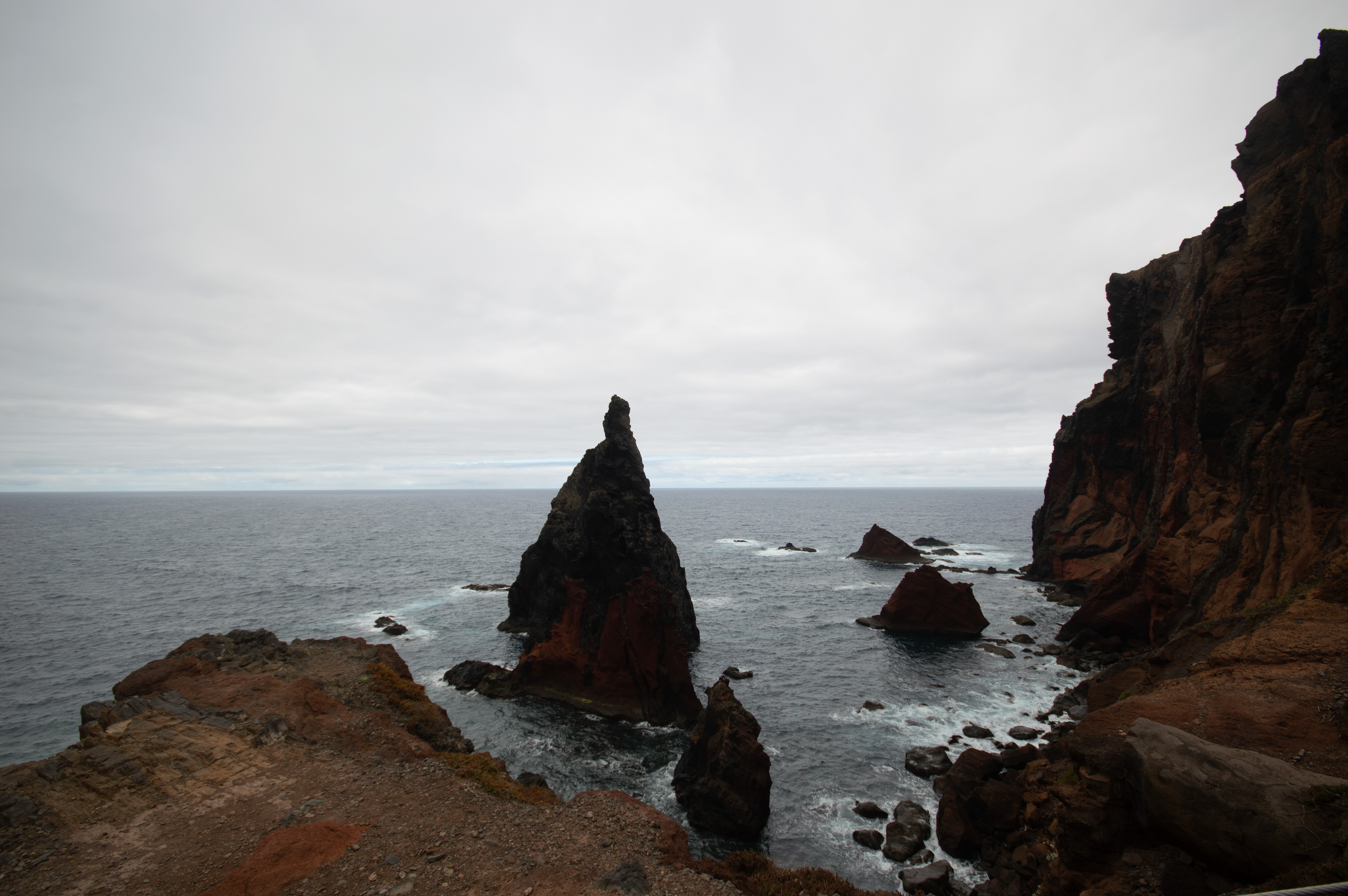
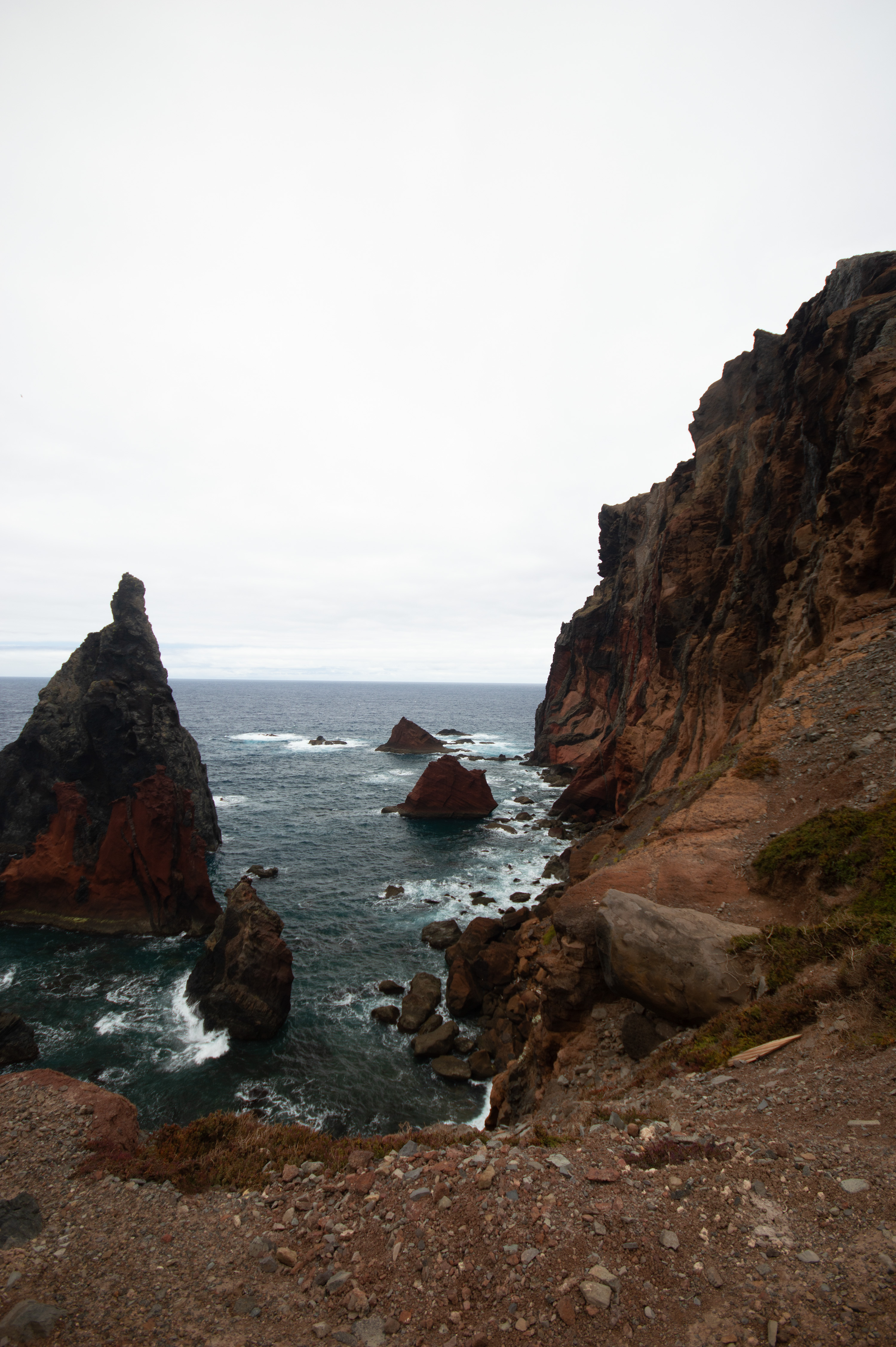
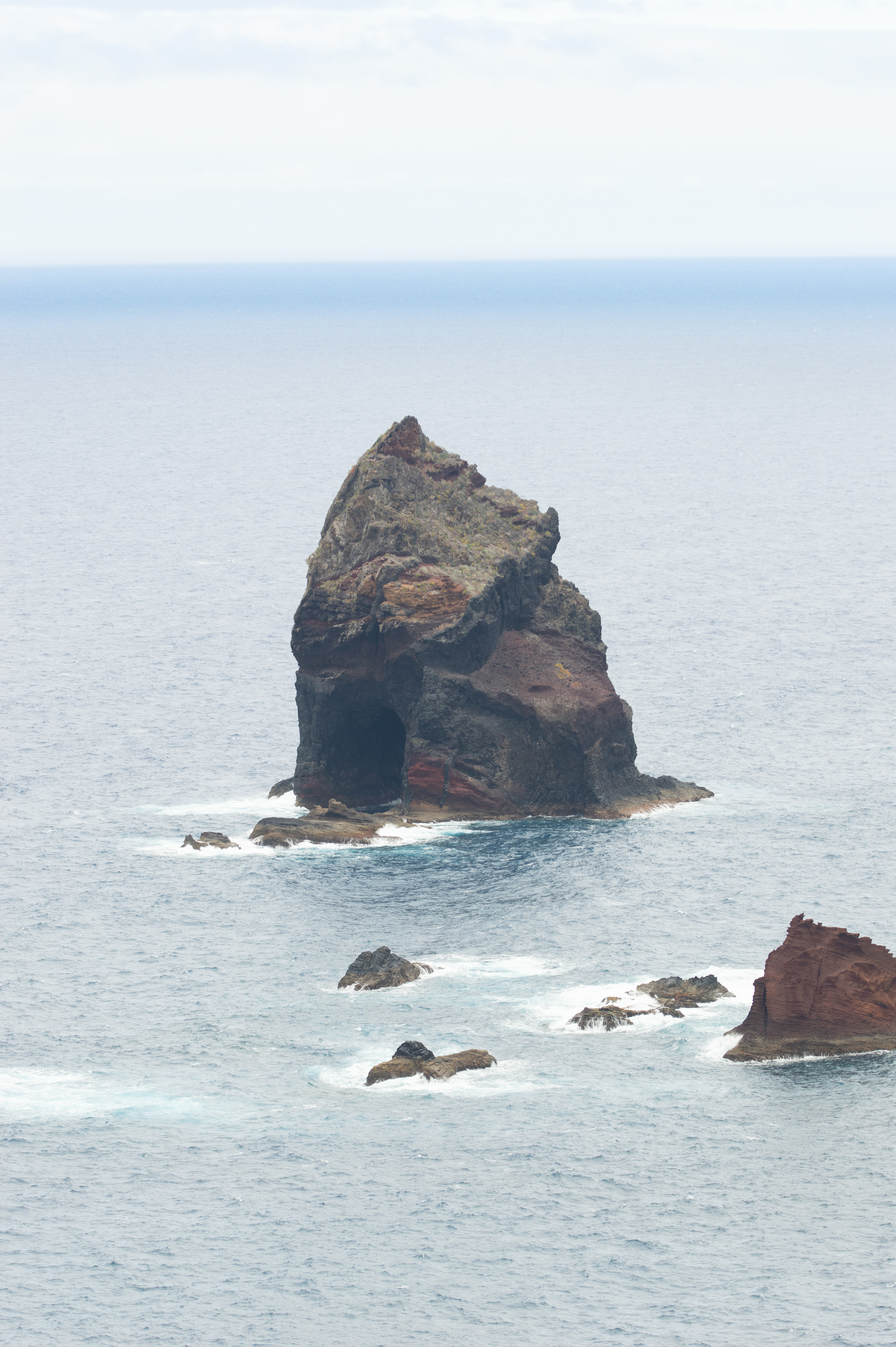
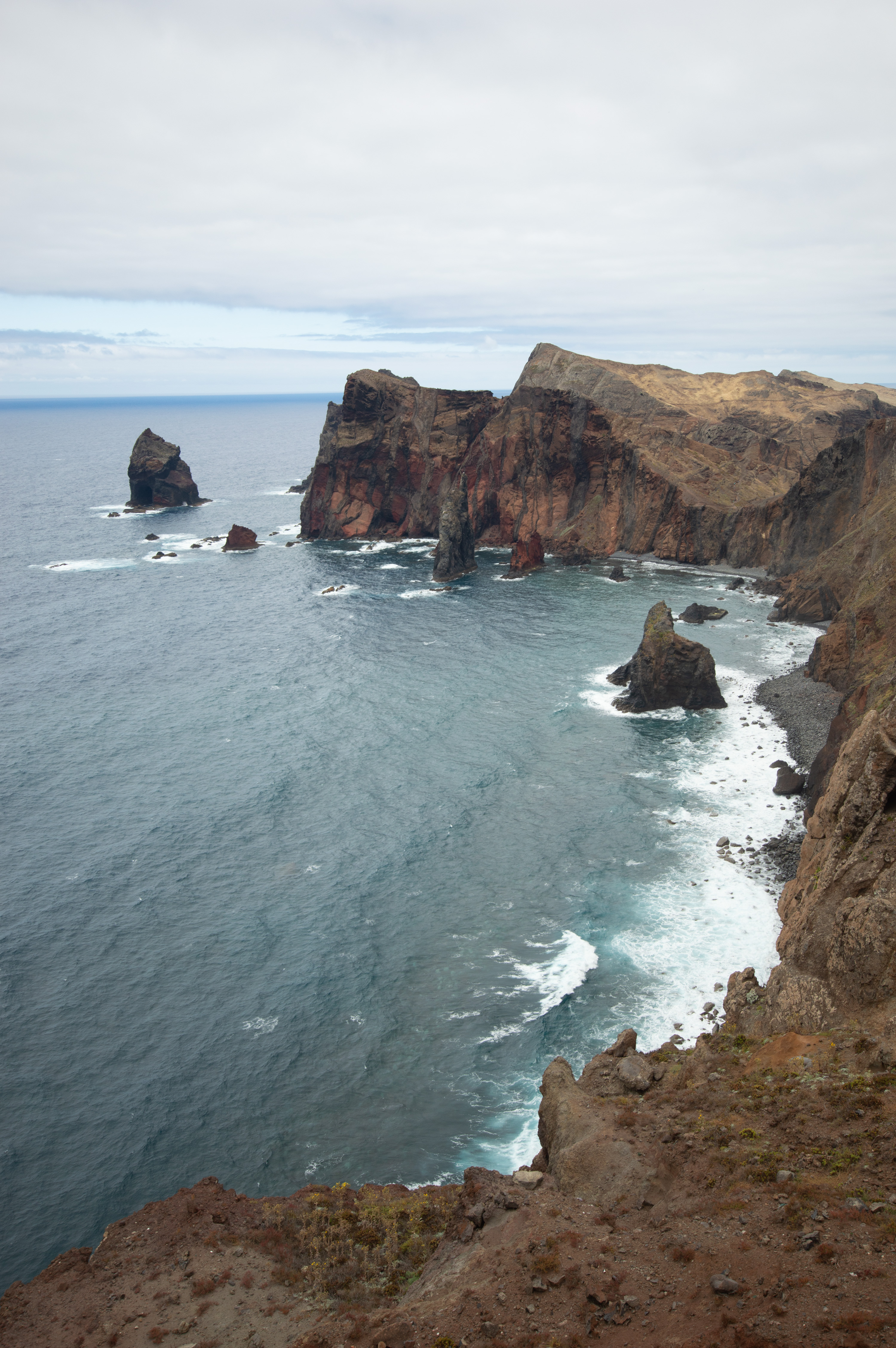
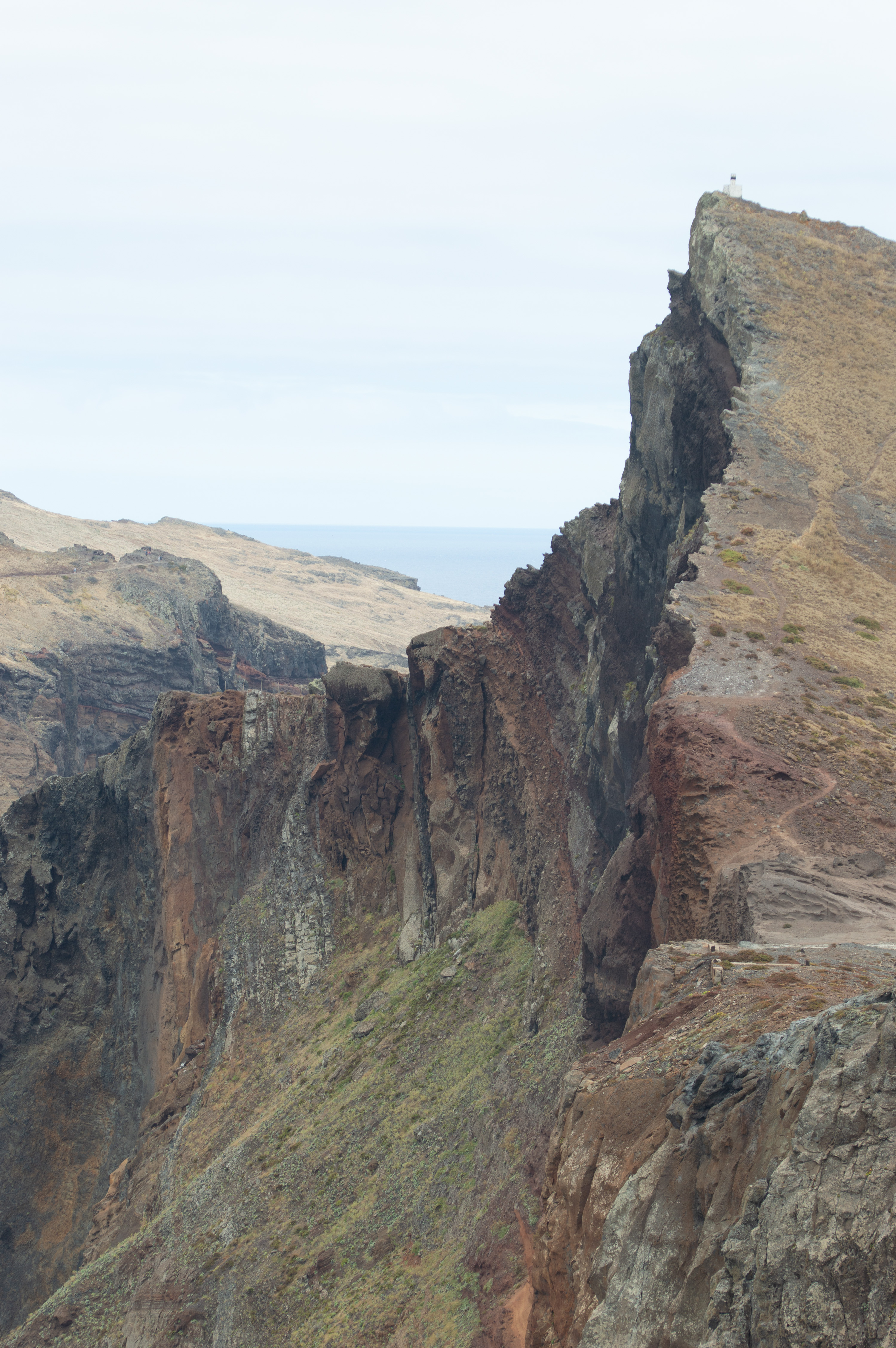
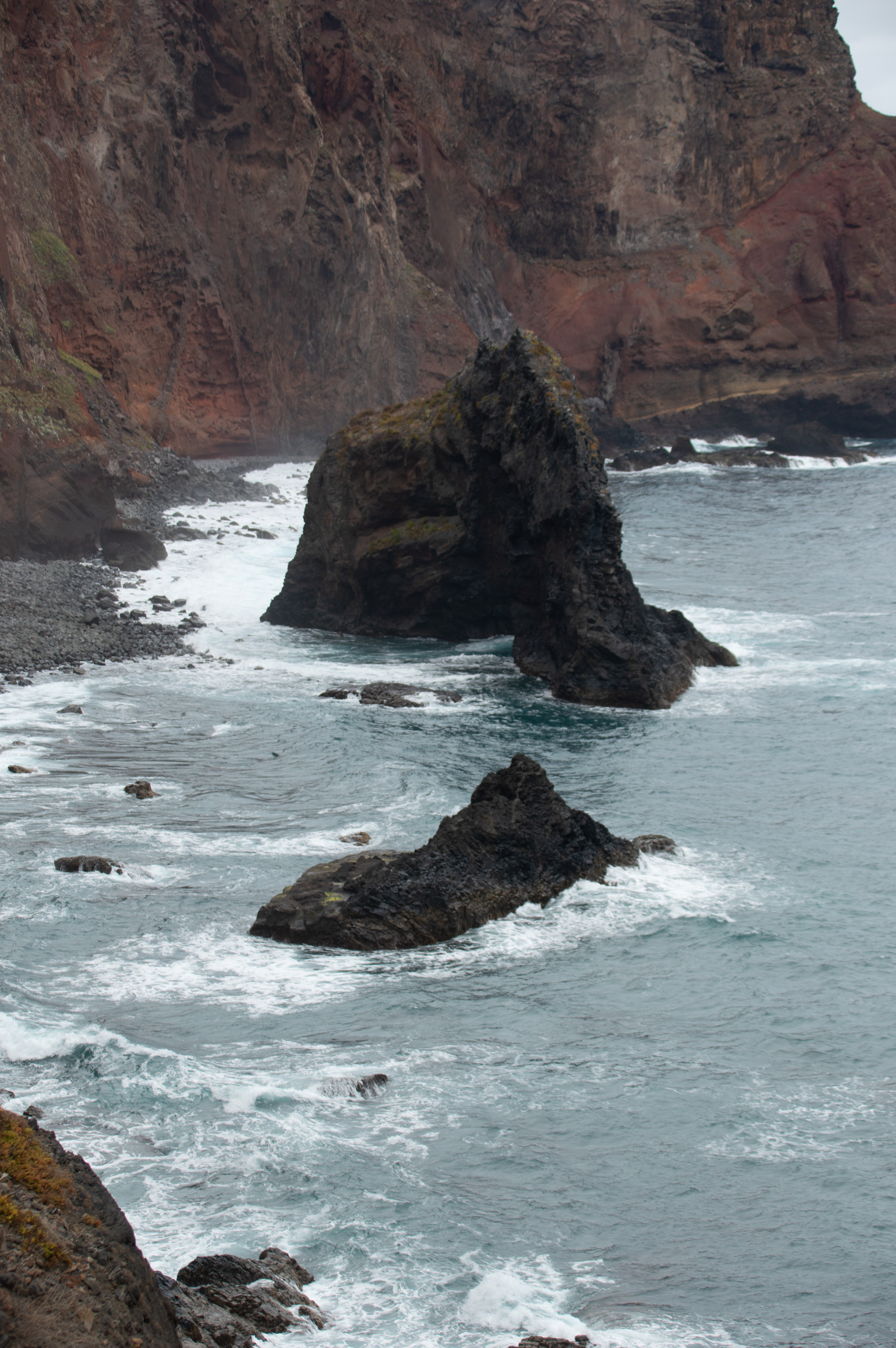
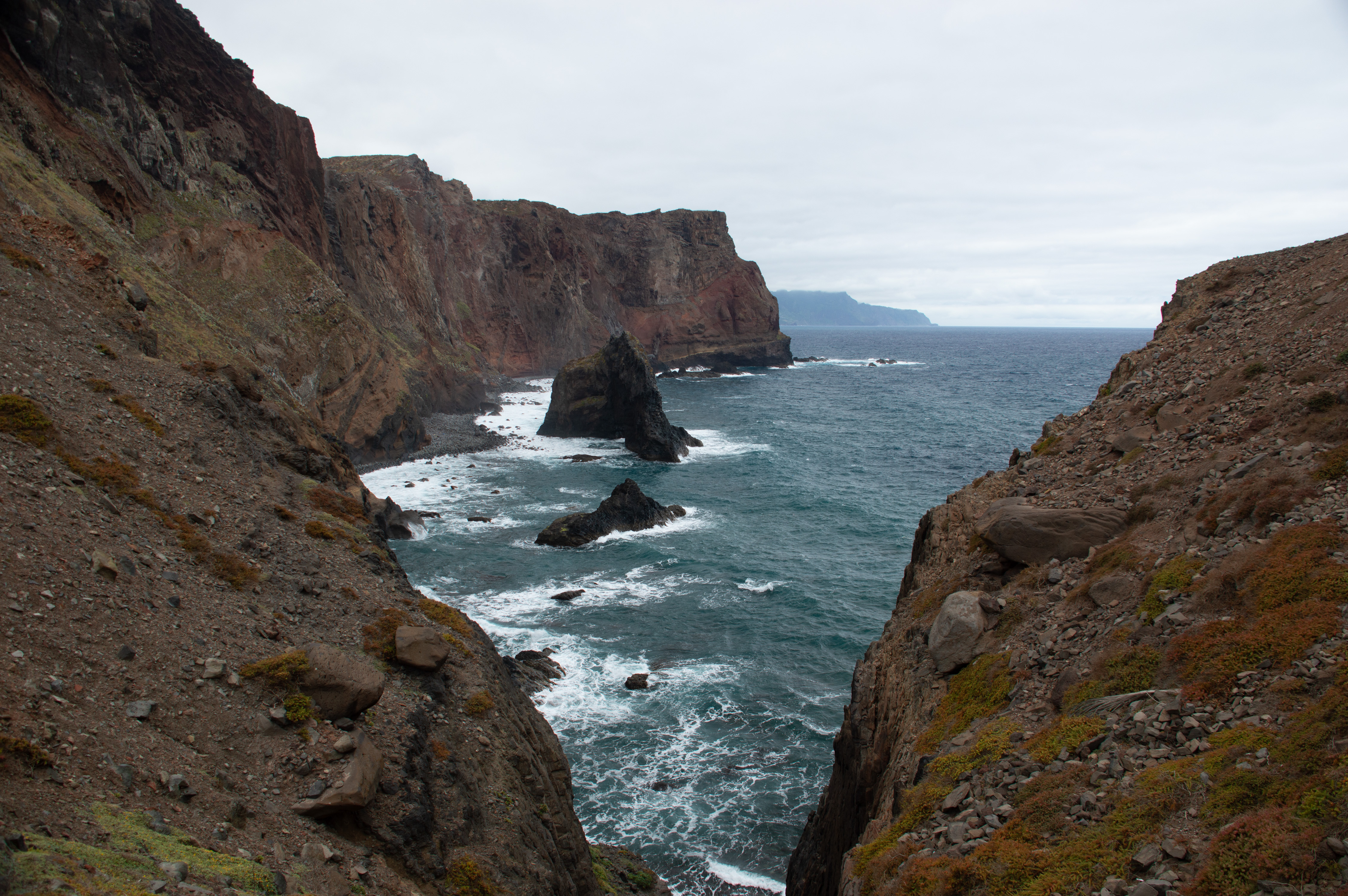
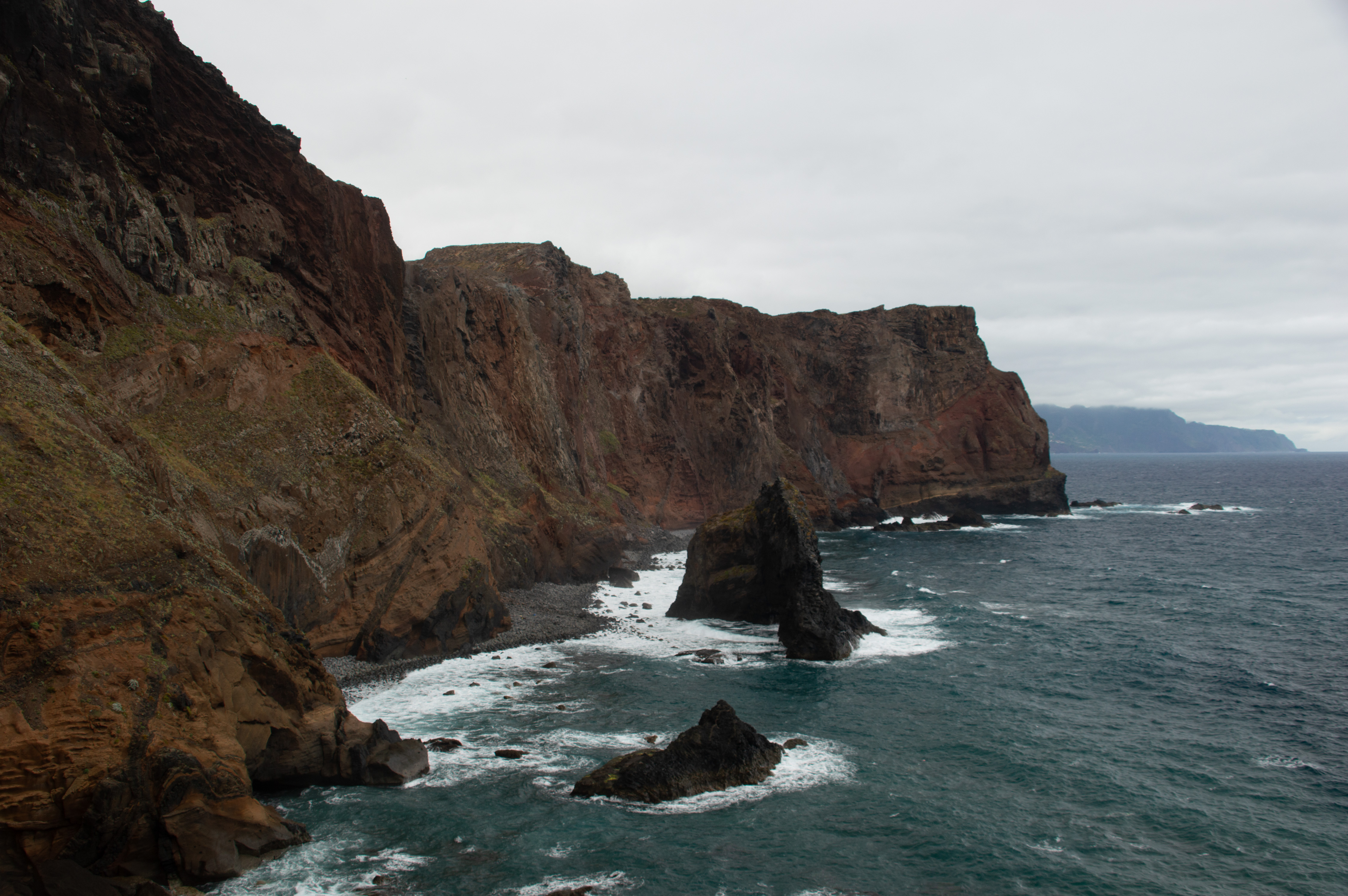
Ponta de São Lourenço is the dramatic easternmost tip of Madeira, a volcanic peninsula known for its rugged cliffs, unique flora, and panoramic hiking trails. It’s both a nature reserve and one of the island’s most iconic viewpoints, offering a blend of geology, ecology, and adventure

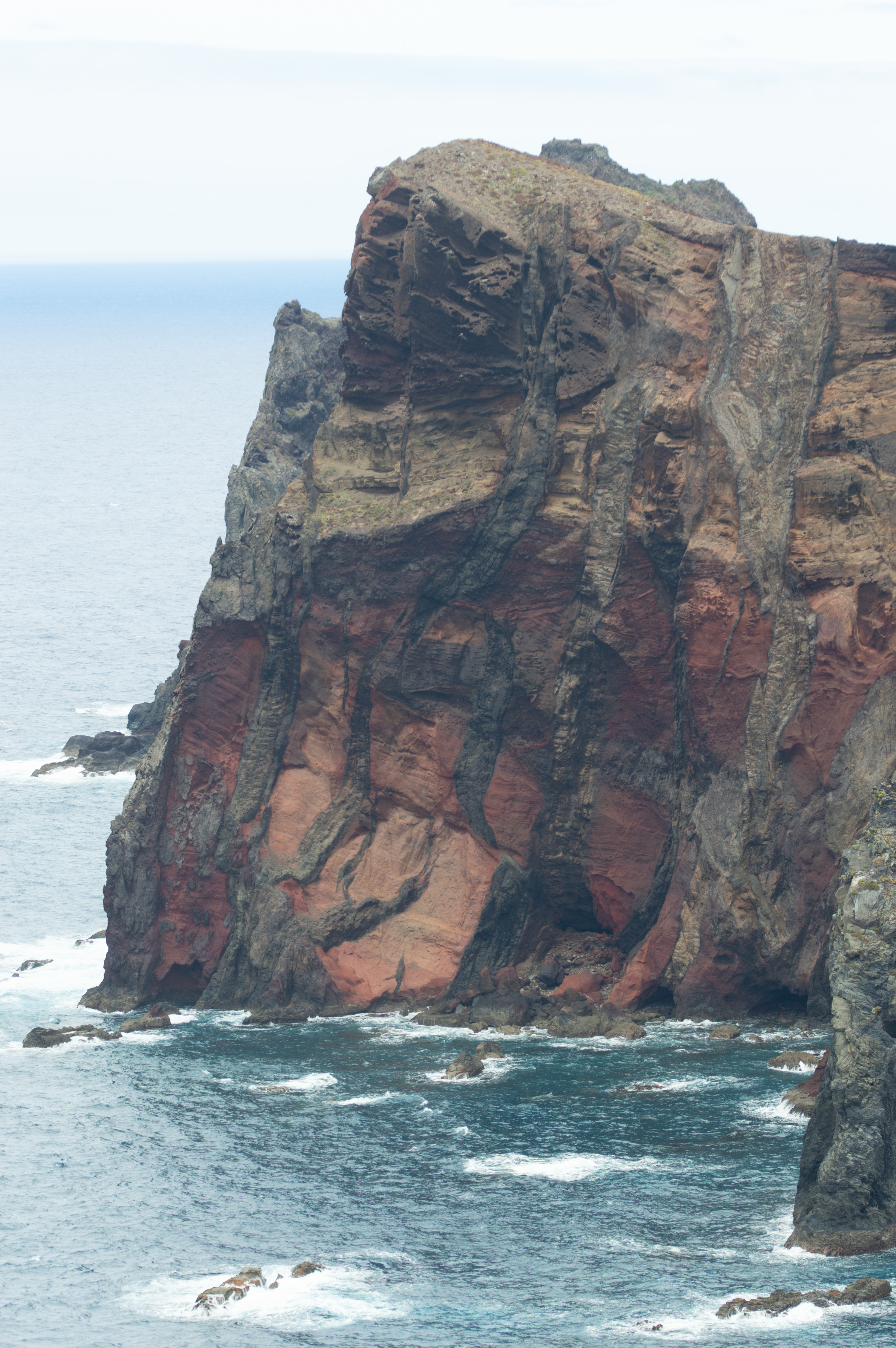
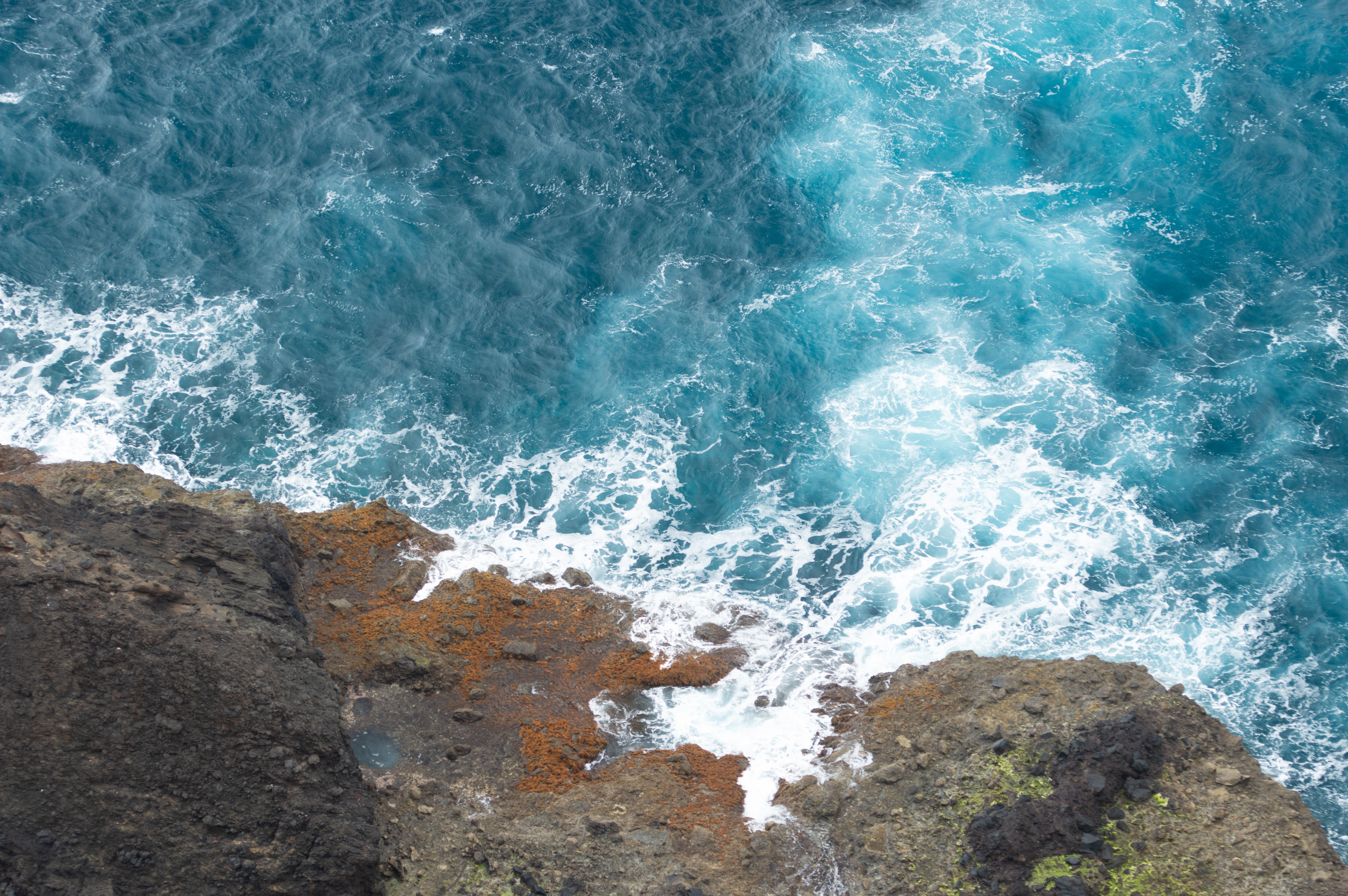
Formed of pyroclastic rocks and basalt dykes, dating back to the Late Pleistocene (~100,000 years ago) Climate: Semi-arid, windy, with sparse vegetation compared to the lush interior. Wildlife: Endemic plants (e.g., Matthiola maderensis, Echium nervosum) and seabird colonies, plus occasional sightings of monk seals.

Trail Length: 3 km each way (6 km round trip)
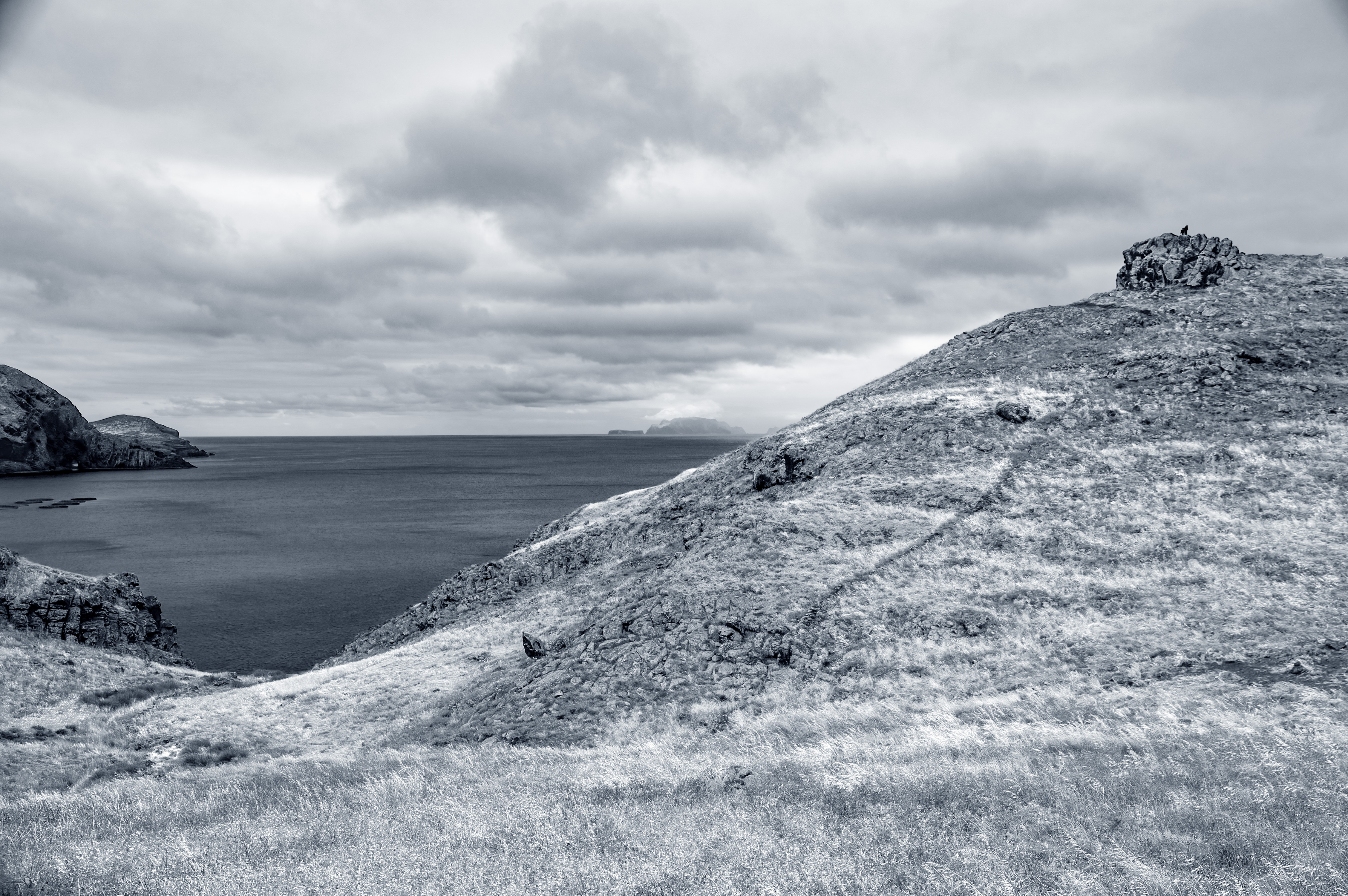
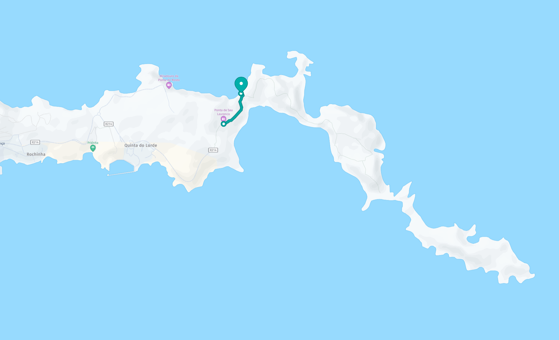
Difficulty: Moderate – undulating terrain, stairs, and strong winds
Duration: About 2.5 hours

Highlights

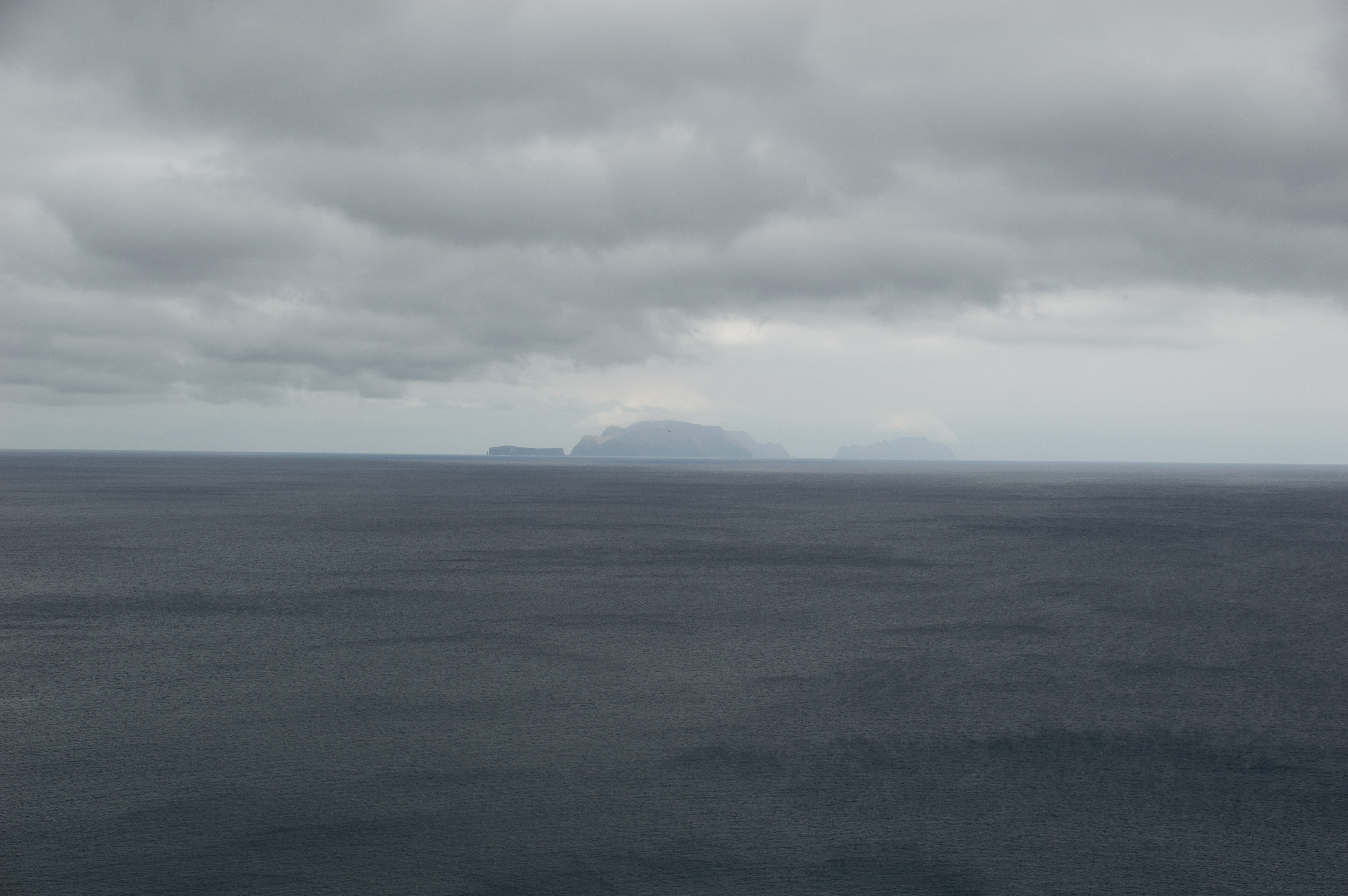
Panoramic views of both north and south coasts
Sunrise and dramatic cloudscapes at the peninsula’s tip
Chance to swim at Cais do Sardinha after the hike

Ponta de São Lourenço offers a raw, elemental landscape unlike the rest of Madeira. It’s a place where volcanic geology, Atlantic winds, and seabird colonies converge, making it both a scientific treasure and a deeply symbolic frontier of the island. For someone like you, Michael, who thrives on layered meaning and ecological symbolism, this peninsula is a living atlas node—linking geology, migration, and cultural archetypes in one windswept setting.

References

en.wikipedia.orgvisitmadeira.comrookiexplorers.com , Text generated by Microsoft CoPilot
To the top
Powered by w3.css. The images are all stored on link to www.gaylard.co.uk Photostream on Flickr   This website is hosted by link to 123Reg Web Hosting